


Welcome
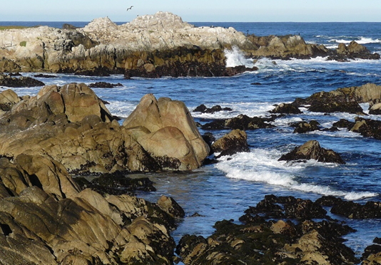
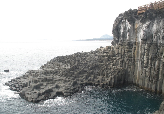

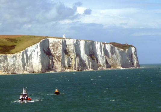


There is an astonishing variety of coastal settings on Earth. Coastline types include rocky shores, sandy beaches, expansive mudflats, steep granite mountains plunging into the ocean, chalky bluffs, and even hexagonal basaltic columns such as those found in the Devil’s Causeway in Ireland or on the South Korean island of Jeju. These differences in coastal settings are caused by many factors, including tectonic history, climate regime, riverine influences, the action of waves and tides, and the erosion and deposition of materials that make up the Earth's crust. A high-resolution map of Earth's coastlines and a standardized global inventory of the ecological settings in which coastlines occur has been developed and can be accessed using the new Global Coastline Explorer. The new coastlines data are also available for download.
Global Coastline Explorer (GCE)
This resource was developed by the U.S. Geological Survey (USGS) in partnership with Esri and the Marine Biodiversity Observation Network (MBON). The tool was developed as part of a Group on Earth Observations (GEO) initiative called GEO Ecosystems (GEO ECO), and is associated with a GEO ECO task to develop global coastal ecosystems data. The tool allows for the visualization and query of any stretch of coastline on Earth, except for Antarctica. The underlying data are 4 million 1 km or shorter coastal segments, each of which is attributed with values from ten ecological settings variables representing the adjacent ocean, the adjacent land, and the coastline itself.
The 4 million coastal segments were classified into 81,000 coastal segment units (CSUs) using the Coastal and Marine Ecosystem Classification Standard (CMECS). Each distinct CSU is a segment with a unique combination of the classes of values of the ten ecological settings variables. The 4 million segments were also clustered into a set of 16 global groups of coastlines which are similar in the aggregate ecological setting described by the ten variables.
The complete set of methodological details and results from the global coastline segmentation analysis are available in Sayre et al. (2021).
The geospatial linework used for the global segmentation, classification, and clustering is the same Global Shoreline Vector (GSV) data used in the companion tool we developed for exploring the location, shape and size, and name of the islands of the planet. That companion explorer tool is called the Global Island Explorer (GIE). The derivation of the GSV from 30m spatial resolution satellite imagery is described in Sayre et al. (2018).
Global Coastline Data
References:
Sayre, R., K. Butler, K. VanGraafeiland, S. Breyer, D. Wright, C. Frye, D. Karagulle, M. Martin, J. Cress, T. Allen, R. Allee, R. Parsons, B. Nyberg, M. Costello, F. Muller-Karger, and P. Harris. 2021. Earth's coastlines. In Wright, D. and C. Harder (eds), GIS For Science, Volume 3: Maps for Saving the Planet. Esri Press, Redlands, California.Sayre, R., S. Noble, S. Hamann, R. Smith, D. Wright, S. Breyer, K. Butler, K. Van Graafeiland, C. Frye, D. Karagulle, D. Hopkins, D. Stephens, K. Kelly, Z, basher, D. Burton, J. Cress, K. Atkins, D. van Sistine, B. Friesen, B. Allee, T. Allen, P. Aniello, I Asaad, M. Costello, K. Goodin, P. Harris, M. Kavanaugh, H. Lillis, E. Manca, F. Muller-Karger, B. Nyberg, R. Parsons, J. Saarinen, J. Steiner, and A. Reed. 2018. A new 30 meter resolution global shoreline vector and associated global islands database for the development of standardized global ecological coastal units. Journal of Operational Oceanography – A Special Blue Planet Edition. DOI:10.1080/1755876X.2018.1529714.
Contacts:
Roger Sayre, U.S. Geological SurveyJill Cress, U.S. Geological Survey, GCE Developer and Webmaster